Showing posts with label Middle Woodland. Show all posts

Friday, April 12, 2019

A Different View of the Early and Middle Woodland Periods in Southwestern Pennsylvania

Paul A. Raber
Heberling Associates, Inc.

Like the rest of us, archaeologists get set in their ways. They become used to looking at the same types of archaeological sites and doing so in the same ways. Sometimes it takes an outside force to pull them away from their pet subjects and ingrained habits. Cultural resource management (CRM) studies required by federal and state historic preservation laws and regulation have served this purpose in North American archaeology over the past half century. Archaeological field studies directed by the dictates of project design have come to dominate the practice of archaeology in the United States, with highway improvements and public works projects defining areas of required archaeological testing and study. Archaeologists may grumble about the limitations imposed on their interests by project boundaries and scopes—the really great site that we know is just outside the project area—but CRM studies have benefited the discipline of archaeology by directing the attention of archaeologists to settings and sites that we might otherwise have ignored.

Recent archaeological studies in connection with a highway project in southwestern Pennsylvania highlighted this phenomenon. Proposed federally-funded improvements to State Route 519 in North Strabane Township, Washington County required that the Federal Highway Administration (FHWA) and the Pennsylvania Department of Transportation (PennDOT), Engineering District 12-0 consider possible project effects to archaeological sites. Among the precontact archaeological sites discovered during preliminary surveys was a small site overlooking a tributary to Chartiers Creek. Initial testing and subsequent large-scale excavation of site 36WH1729 revealed the remains of numerous brief encampments there, almost all of which dated to the Early and Middle Woodland periods, roughly spanning the period 1000 BC to 1000 AD (Raber 2018). This was a time of profound change in the Native cultures of eastern North America, witnessing the first sustained experimentation with plant crops, new technologies like pottery, and connections with regional ceremonial complexes like Adena and Hopewell based in the Middle Ohio River valley to the west (see previous posts here and here, for example).

Our understanding of this period and the ties of local peoples to the Adena and Hopewell complexes, however, has been heavily influenced by the traditional focus on the sometimes spectacular remains found at mound sites like McKees Rock Mound and dozens of other burial mounds in southwestern Pennsylvania and adjacent regions of the upper Ohio Valley, or those uncovered at semi-permanent hamlet or village sites like those at the Fairchance Mound and Village site in nearby West Virginia. Available archaeological information is heavily biased towards those site types.

The work at 36WH1729 joins several other recent studies in drawing attention to the distinctive set of activities and the use of local resources that occurred at small, briefly occupied campsites in the Ohio Valley and elsewhere in Pennsylvania (see Nass and Henshaw 2017; Raber 2017a, 2017b). Such studies have contributed detailed information on what happened at these small sites and how the sites were related to seasonal occupations at larger base camps and other specialized sites through large-scale exposures and intensive post-excavation studies of artifacts and features.

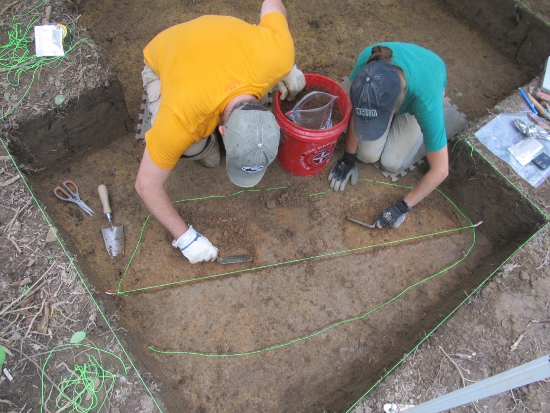
The excavations at 36WH1729 exposed roughly 26% of the core site area, recovering more than 6400 stone artifacts and pottery fragments and 178 kg of fire-cracked rock. The exposure of 93 m2 revealed twelve confirmed or likely pre-Contact cultural features, all of which seem to have been hearth or hearth remnants, as would be expected at small, briefly occupied camps, where the family or task group present would have gathered around a hearth to cook, socialize and conduct most of the varied activities documented in the excavated remains. We defined the dates of occupation with 15 radiocarbon dates on charcoal taken from features and other contexts.

The results of excavation and post-excavation analyses provide a detailed picture of life at a  small upland camp used repeatedly during the Early and Middle Woodland periods. Studies of microscopic wear on stone tools allowed us to characterize some of the activities that occurred at successive camps at 36WH1729, while analyses of pollen and residues on both stone tools and pottery expanded our knowledge of the local environment, activities, and the materials obtained and used at the site. Small groups—probably nuclear families—camped here for short periods during the fall, hunted white-tailed deer and other game, and collected nuts and other wild plants available in the cleared areas around the site. Much of the activity seems to have focused on the collection and processing of black walnuts, the butchering of deer carcasses for meat, and the working of hides, bone, and antler. Most of the meat, hides, and nuts were processed and preserved to be later used or consumed at seasonal camps.

These tasks were accomplished using flaked stone tools of local Uniontown chert that was obtained within a short distance of the site. Some 97% of the toolstone used at 36WH1729 was Uniontown chert obtained from nearby—but currently undefined—sources. The site was occupied for perhaps a few days or a week during the fall, when the nut crop and game could be harvested in the vicinity of the camps. The inhabitants returned to base camps or hamlets along the larger streams’ drainage for the winter season. They must also have used nearby Early and Middle Woodland period burial mounds, but there is no evidence to indicate that they visited the mounds while camped at the site.

The studies at 36WH1729 provided a new perspective on life during the Early and Middle Woodland periods in the upper Ohio Valley, one very different from that derived from the traditional focus on burial mounds and villages. The daily lives of families and small bands, and their intimate knowledge of the changing local environment evident in the use of resources like Uniontown chert, deer and wild plants, are all delineated in the material remains from small sites like 36WH1729. As the body of our knowledge of small sites accumulates, we can ask new and more detailed and relevant questions about how the past inhabitants of the region lived and adapted to changing conditions.

Our ability to ask such questions, however, depends on paying attention to the small sites that were critical parts of past settlement systems. Giving such small sites their due reflects the major impact CRM archaeology has had on the study of the past.


References:
Nass, John P, Jr. and Marc Henshaw
2017    The Value of Small Sites for the Study of Late Woodland Subsistence: An Example from Southwestern Pennsylvania. Journal of Middle Atlantic Archaeology 33:27-48.
Raber, Paul A.
2017a  The Significance of Small Sites in the Upper Ohio River Drainage: Investigations at 36WH1619. Pennsylvania Archaeologist 87(1):1-28.
2017b  Eight Thousand Years on the Banks of Aughwick Creek: archaeological Studies at 36HU224, The Pogue Bridge North Site. Byways to the Past Series. The Pennsylvania Department of Transportation and Pennsylvania Historical and Museum Commission, Harrisburg.

2018    The Early and Middle Woodland Periods at Small Site in the Upper Ohio Valley: The Evidence from 36WH1729. Pennsylvania Archaeologist 87(1):1-28. 


For more information, visit PAarchaeology.state.pa.us or the Hall of Anthropology and Archaeology at The State Museum of Pennsylvania .

Friday, June 2, 2017

The Archaeology of Three Mile Island


With Three Mile Island once again in the headlines as of late, what better time could there be than now to share some additional information about the archaeology of the island that hosts the nation’s most infamous nuclear power plant.

Residents of central Pennsylvania (of a certain age) can recall exactly where they were and what they were doing when they received word about fears of a meltdown at the plant in late March of 1979. Truly a “where were you?" moment in history outdone only by the disasters at Chernobyl and, more recently, Fukushima. 

Avid followers of TWIPA will recall a previous post thoroughly reviewing the excavation and artifact analysis of the northern-most site on the island, 36Da50, and it can be found here. There have been, over the course of the last 50 years, eight additional archaeological sites registered on Three Mile Island.

First, enjoy a few newpaper clippings and the formal press release from that initial work conducted in 1967 that are now themselves as of this year technically, historic.


 “The Metropolitan Edison Company in developing and creating the Three Mile Island complex made every effort to cooperate with concerned environmental and historical groups. Long before the establishment of State Offices of Historic Preservation or the need for Environmental Impact Statements, the Pennsylvania Historical and Museum Commission requested and received from the electric company a grant to examine prehistoric remains on the island and to obtain a sample sufficient to be able to reconstruct its culture history” (Smith 1977)


“The types and relative quantities of lithic artifacts, as well as, the horizontal distribution of ceramic artifacts suggests that Three Mile Island was occupied intermittently by small groups of Early and Middle Woodland peoples utilizing a local fish or animal resource.”(Smith 1977)

The Middle Woodland cord-marked storage vessel seen below was excavated, and ultimately donated by Monroe Brown to the State Museum where it was then reconstructed in the early 1970s. Assigned to site 36Da52, the provenience information indicates it was discovered eroding out of a pit on the southern bank of the island. Generous contributions like Mr. Brown’s go a long way in enhancing our collective understanding of Pennsylvania prehistory.


Sites 36Da96 through 36Da99 were recorded with the Pennsylvania Archaeological Site Survey in 1976 and are attributed to the work of Tom Grace and others. Mr. Grace worked at TMI as GPU Nuclear’s environmental licensing engineer, and for several years, as weather and time would permit, he would hunt for artifacts on undeveloped parcels of the island. His enthusiasm for archaeology and some of his discoveries were highlighted in the fall 1987 edition of GPU Nuclear Today, a periodical published for employees working at the plant and their families. His findings were consistent with earlier work and reinforced ideas about how long people had been occupying the island.


In the 1980s, another employee at TMI, Gary Prinkey, was also scouring the island for artifacts. On one excursion, he uncovered a fragment of a human skull eroding out of the bank of the island. Unsure whether the deceased was a victim of crime, Prinkey notified the State Police. State Museum of PA curator of archaeology Steve Warfel was contacted and investigated the grave site with Trooper John Brown in February of 1988.  The presence of wood fragments and cut nails indicated to Warfel the remnants of a coffin, dispelling any notion of nefarious deeds. Furthermore, vest buttons recovered from the site (36Da101) were identified as a particular type manufactured between 1850 and 1880. Likely an inhabitant farming TMI in the late19th century, their remains were re-interred further inland on the island after analysis.  

In the mid-nineties archaeologists re-identified site 36Da51, the second of three sites originally recorded in 1967, during survey and evaluation work in connection with a proposed fish passage facility on the southeastern side of the island. Phase II work determined that what was initially considered a buried A horizon containing chipping debris, a few sherds of Early/Middle Woodland ceramics and FCR was actually the historic plow zone from 19th century farming activities. The disturbed nature of the soils in the the project area precluded any additional archaeology. 

Finally, the most recent archaeological investigations on TMI were conducted in 2014 in anticipation of a “Nature-like Fishway” construction project on the southwest side of the island. At this site, 36Da100, archaeologists observed stratified and sealed deposits, the earliest of which contained a Thebes projectile point made of jasper. Thebes projectile points are classified as Early Archaic in age and date between 10200 and 11700 years before the present. Due to its potential to contain significant new information, this site has been determined eligible to the National Register of Historic Places. If construction plans cannot be designed to avoid the site, a data recovery effort may be necessary to mitigate adverse effects the project may have on this important cultural resource.


For archaeologists, there’s just no such thing as TMI about TMI.

References:

Franz, D. (2015)
Phase I Archaeological Investigations for the proposed Nature-like Fishway at the York Haven Hydroelectric project. Brockington & Assoc.

Geidel, Richard (1998)
Phase I and II Archaeological Investigations 36Da51 East Channel Fish Passage Facility, Three Mile Island, Dauphin County, PA. KCI Technologies

Smith III, Ira F. (1977)
Early and Middle Woodland Campsites on Three Mile Island, Dauphin County, PA. PHMC

Warfel, Stephen G. (1988) A Report on the Discovery of a Human Skeleton at Three Mile Island, Dauphin County, PA. The State Museum of PA


For more information, visit PAarchaeology.state.pa.us or the Hall of Anthropology and Archaeology at The State Museum of Pennsylvania .

Friday, July 1, 2016

Jack's Reef in July

Jack’s Reef Pentagonal and Jack’s Reef Corner-notched points are distinct markers in the prehistoric archaeological record of the Middle Atlantic (including Pennsylvania), the Midwest, and the Northeast. The angled blade margins create four sides with a straight or slightly concave base. The base creates a fifth margin in both the pentagonal and corner-notched forms. Concurrently in northwestern Pennsylvania and parts of the Midwest, the Raccoon-notched point variety, a smaller pentagonal point, was also utilized and is sometimes found in the same archaeological contexts as slightly larger Jack’s Reef points.


Jack's Reef points

It is interesting that the Jack’s Reef style or type was used for a relatively short span of about 500 years (950 - 1450 BP) but over a large geographic area (from Michigan to Maine) by many different Native American groups. It is the generally agreed that these very distinctive projectile points represent the widespread incorporation of the bow and arrow into the prehistoric tool kit about 1500 years ago (Justice, 1987). Triangle points have been found as early as Middle Archaic contexts in Pennsylvania and other states, indicating that bow and arrow hunting technology may have been used prior to the Woodland period. However, these early triangles are not common and it is unclear if they represent bow and arrow technology. The relatively larger projectile point styles and the presence of bannerstones in Archaic contexts support the assumption that spears and atlatl darts were the primary implements used in hunting activities prior to the presence of Jack’s Reef points.

They are produced using a refined pressure flaking technique to create a flat thin blade or flake blank which is further refined with pressure flaking. Recent excavations in Virginia and Delaware have uncovered flake cores used to create Jack’s Reef preforms. The technique is described as “pseudo- Levallois” or “Levallois-like” (Lowery 2013; Walker 2013, New Jersey). While other core techniques may have been used to create Jack’s Reef Points in other regions, including parts of Pennsylvania, the point pictured below was also made from a flake blank, rather than a bifacial preform. The smooth ventral surface of the original flake from which this point was made is clearly visible.


Jack's Reef points were preferentially made from cryptocrystalline lithic materials, predominately high quality local chert in western Pennsylvania and local cherts as well as Hardyston jasper in the Susquehanna and Delaware River basins. McCounaghy (2013) concludes the reliance on local source material and the wide spread adoption of the Jack’s Reef point style by different cultural groups throughout Pennsylvania is evidence that the introduction of this point style does not represent a mass migration of people, but rather the diffusion of ideas through cultural interaction between existing populations.

As an example, in the Ohio drainage of western Pennsylvania, Jack’s Reef points are utilized by two distinct groups, the Late Watson Farm in the southwest and Allegheny River cultures in the northwest. Both the Late Watson Farm and Allegheny River complexes demonstrate continued influence and interaction with the post-Hopewellian cultures of the Ohio valley. Archaeologists specializing in the Midwest tend to use a different set of chronological terms for this time period, placing the end of the Hopewell sphere of influence around A.D. 400 as the end of the Middle Woodland. Therefore in western Pennsylvania literature, Jack’s Reef points are classified as Late Woodland (McConaughy 2013). Obviously, this has created some confusion in the archaeological literature. In eastern Pennsylvania, this cultural period is commonly referred to as the late Middle Woodland. Jack’s Reef points are associated with the early and middle Clemson Island culture in the West branch and Juniata Valley of the Susquehanna River basin, and the Abbott Farm Complex of the lower Delaware.

 Map of Jack’s Reef and Raccoon Notched points in Pennsylvania (McConaughy 2013)

It is widely theorized that the adoption of the bow and arrow co-occurred with the intensification of food production using weed seed plants of the Eastern Agricultural Complex (EAC) as well as potentially experimenting with maize horticulture. However, the current understanding of this pivotal time period—the transition from a foraging life style to one of intensive maize horticulture, in villages with complex tribal social organization—is limited by the paucity of the archaeological record. Relatively speaking, very few sites have been recorded for this time period as compared to the preceding Late Archaic and subsequent Late Prehistoric/Late Woodland periods.  Additionally, very few of those sites recorded have been systematically excavated with particular emphasis on recovering the floral and faunal record.

                  Pentagonal and Levannas points from Memorial Park (GAI 1995)

One exception is the Memorial Park site (36Cn164) in Lock Haven on the West Branch of the Susquehanna River. Jack’s Reef points are associated with the early and middle Clemson Island cultural components at this site. It is characterized as a multi-component small hamlet with numerous features. Flotation analysis demonstrated a dietary reliance on nut resources (hickory, walnut, butternut, acorn and chestnut) as well as some of the earliest evidence of maize in addition to the utilization of domesticated weeds seeds (little wild barley, chenopod, amaranth, smartweed, and sunflower seed). Unfortunately, the faunal analysis grouped all Woodland deposits together. However, white-tailed deer and fish, including sucker, catfish and perch, were major dietary components of all Woodland period hunting and fishing activities recovered at the site. (McConaughy 2013; Hart & Sidell 1996; GAI Consultants, Inc. 1995)
Memorial Park Clemson Island features (Hart & Sidell 1996)

Jack’s Reef projectile points are an important temporal marker of a very interesting time of transition in Pennsylvania prehistory. A comprehensive summary of the larger historical and regional context of the Jack’s Reef phenomenon is available in the Eastern States Archaeology Federation (ESAF) publication, Archaeology of Eastern North America (AENA), 2013, Volume 41. It is a compendium of the papers delivered at the 2012 ESAF meeting, After Hopewell: The Jack’s Reef Horizon and Its Place in the Early Late Woodland Mortuary and Settlement Patterns in Northeastern North America.


References:
GAI Consultants, Inc
1995       Archaeological Investigations at the Memorial Park Site (36Cn164), Clinton County, Pennsylvania. Final Report. On file The State Museum of Pennsylvania, Section of Archaeology.
Hart, John P. and Nancy A. Sidell
1996       Prehistoric Argicultural Systems in the West Branch of the Susquehanna River Basin, A.D. 800 to A.D. 1350. Northeast Anthropology, 52:1-30.
Justice, Noel D.
1987       Stone Age Spear and Arrow Points of the Midcontinental and Eastern United States, 215-220.
Lowery, Darrin L.
2013       Jack’s Reef in the Chesapeake and Delmarva Region: Research into the Coastal     Archaeology of the Era Between Circa cal A.D. 480  and cal A.D. 900. AENA 41:5-30.
               
McConaughy, Mark A.
                2013       The Jack’s Reef Horizon in Pennsylvania: A Preliminary Assesment. AENA 41:     31-46
Walker, Jesse
                2013       An Examination of Jack’s Reef in New Jersey. AENA 41:47-58.    

Further Reading:


For more information, visit PAarchaeology.state.pa.us or the Hall of Anthropology and Archaeology at The State Museum of Pennsylvania .

Friday, August 21, 2009

Woodland Period Cremation Cache from Union County, Pennsylvania

The Cache
A cremation cache (Feature 2) was discovered in 2003 by Pennsylvania Historical and Museum Commission archaeologists during subsurface testing at site 36UN10, for the proposed Union County Business Park located north of Allenwood, Pennsylvania. The contents of this cache included eight ovate-shaped bifaces of gray colored tabular chalcedony, a hellgrammite point/knife of gray banded rhyolite, a two-hole gorget of gray siltstone and a faceted sphere of graphite. Fragments from two of the eight chalcedony bifaces were cross-mended and along with the others show evidence of heat fracturing from the cremation process.


Chalcedoncy blades and Hellgrammite Point

The thick mass of charcoal encapsulating the cache had traces of co-mingled calcine bone, ash and burnt soil which we believe to be the remains of non-organic cremated residue. Some of the cultural objects were inadvertently displaced by the backhoe operator, therefore, we are unsure of their original positions within the cremation pit. Careful investigation by PHMC archaeologists, however, concluded that the cache must have rested on the pit floor since in situ remnants of the cremated mass was found there.

Other Pit Features
A short distance southeast from the cremation pit, another pit (Feature 3) was excavated that contained charred fragments of sheeted bark, possibly the remnants of material used as pit lining. The contents of Feature 3 include a small Lamoka-like point, burned sandstone fragments, sandstone cobble hammerstone and chert, jasper, silicified siltstone and rhyolite debitage. A third but smaller pit (Feature 4) having no bark lining but a similar artifact assemblage was also found.

Gorgets and Graphite Sphere

Stratigraphy, Artifacts and another Cultural Context
The overall diversity of diagnostic artifacts recovered from the site suggests that 36UN10 was occupied by Native Americans from the Late Archaic through the Middle Woodland Periods (Range of Appropriate Dates here). However, the tightly compressed site stratigraphy displays little separation in the soil between different cultural groups as the land was reused again and again over a span of 2500 years.

Lamoka points/knives; Susquehanna Broad points/knives; Fishtail points/knives; steatite bowl fragments and Marcey Creek steatite tempered pottery make up the diagnostic artifact assemblages from these strata. The 1992 Phase III archaeological data recovery project of Louis Berger & Associates on the river terrace south of Allenwood (36UN82) documented a similar stratigraphic sequence of human occupation for the West Branch Valley (Wall 2000). There, archaeological investigations revealed a clearer picture in comparison to the mixed Archaic through Woodland sequence at 36UN10.

Examples of artifacts from Strat. 2/2a: top Early Woodland Period, middle Transitional Period, bottom Late Archaic Period

Carbon-14 analysis of the carbonized material found in the intrusive, yet isolated Woodland pits, Features 2, 3 and 4 described above, was employed to demonstrate a distinct chronological separation of the cremation activity found on 36UN10 from the earlier Archaic components also present on the site.

Cremation Chronology
A sample of charcoal directly associated with the cache submitted to the University of Arizona Radiocarbon laboratory returned a date of 1680+/- 40 radiocarbon years B.P., (before present). Utilizing two sigma ranges the corrected dates are 246 AD: 434 AD. Partially preserved charred remains of bark lining in pit (Feature 3) was discovered nearby and likely belongs with the Woodland cremation component at 36UN10. A sample of bark from this pit, also dated by the University of Arizona, yielded a corrected date range of 128 AD: 384 AD.

The overlapping of the two dates would indicate that the features are contemporary and date to the Middle Woodland Period, thus demonstrating that burial ceremonialism continued after the Early Woodland Period ended in the Susquehanna Valley. The presence of a Hellgrammite point/knife with the 36UN10 cremation would imply that the long held notion of Hellgrammite point/knife types being a regional manifestation of the Early Woodland needs to be rigorously tested with more investigations at other comparable sites in the valley. In contrast to the cremation feature found at 36Un10, other mortuary sites of the Susquehanna Valley are radiocarbon dated to the earlier part of the Woodland period (1,000-500 BC.). Artifact assemblages from such sites tend to include Meadowood blades, stone tube pipes, gorgets, copper ornaments and rarely, bird and boatstones (Kent 1994).

References
Kent, Barry C.
1994 Discovering Pennsylvania’s Archaeological Heritage. The Pennsylvania Historical and Museum Commission.

Wall, Robert D.
2000 A Buried Lamoka Occupation in Stratified Contexts West Branch Valley of the Susquehanna River, Pennsylvania. Pennsylvania Archaeologist 70(1):1-44.

For more information, visit PAarchaeology.state.pa.us or the Hall of Anthropology and Archaeology at The State Museum of Pennsylvania .