Thursday, December 31, 2015

We are the Section of Archaeology


Staff Directory

Dr. Kurt Carr, Senior Curator – kcarr@pa.gov
-          Contact for research, internships and public outreach inquiries
Janet Johnson, Curator – janjohnson@pa.gov
-          Contact for intern, volunteer, CRM, loan, research and public outreach inquiries
Jim Herbstritt, Historic Preservation Specialist – jherbstrit@pa.gov
Liz Wagner, Curator – elwagner@pa.gov
Dave Burke, Curator – davburke@pa.gov
Kim Sebestyen, Curator – ksebestyen@pa.gov
Melanie Mayhew, Curator – memayhew@pa.gov
Andrea Carr, Lab Contractor– c-acarr@pa.gov
Callie Holmes, Lab Contractor – c-cholmes@pa.gov

The Section of Archaeology staff preparing for the Kipona Festival on City Island in Harrisburg
Photo: PHMC/The State Museum of PA


About Us

The Section of Archaeology at The State Museum of Pennsylvania curates the largest collection in the museum and is responsible for multiple functions within the PHMC.  Developing and maintaining exhibits in the Hall of Anthropology and Archaeology is a primary function, but our role as the state repository for cultural resource projects is substantial.  Our office is responsible for curating approximately 8 million artifacts representing over 14,000 years of Pennsylvania’s archaeological heritage. The curation and preservation of Native American  and historic period artifacts and their associated records from archaeological sites across the Commonwealth is an essential function requiring collaboration with the State Historic Preservation Office (SHPO)and state, federal and private developers. Prior to construction, a review process conducted by PHMC  archaeologists will identify the impact of water & sewer lines, highway expansion, bridge replacements and private or commercial development receiving state or federal funding. A variety of preservation methods are employed to mitigate the impact of these projects on our cultural heritage.  If an archaeological site can’t be avoided during construction, then an archaeological investigation is conducted. It is through this process that many significant and unique objects of our archaeological heritage are recovered.  Artifacts resulting from these projects represent the bulk of our collection.  These significant collections are available for scholarly examination, and researchers are encouraged to contact the Section of Archaeology for information about using the collections.

Projectile points from the Dutt collection (Chester County) which have been sorted into different types based on form
Photo: PHMC/The State Museum of PA

 Our role as Pennsylvania’s repository for archaeological survey records and collections is part of the environmental review process conducted by the SHPO; additionally, our facility curates archaeological collections of significance from Pennsylvania that have been donated by private collectors. The Section of Archaeology is also responsible for developing and updating the Hall of Anthropology and Archaeology exhibits at The State Museum of Pennsylvania in Harrisburg.   These exhibits present the pre-history of Pennsylvania from approximately 14,000 years ago through the historic period with collections representing military and industrial era sites in Pennsylvania. 
Loans to non-profit organizations are facilitated through the section and have provided opportunities for communities to view the archaeological heritage of their community at the local level.   The PHMC has a renewable loan policy that enables proper monitoring of loan agreements and artifacts.  Local community awareness and appreciation for the archaeological record are greatly enhanced by these displays.

An exhibit of artifacts on loan to the Red Rose Transit Authority in Lancaster from The State Museum’s archaeology collection
Photo: Red Rose Transit Authority


Curation of these irreplaceable objects is provided in a secure curation facility. A climate controlled environment ensures the long term preservation of Pennsylvania’s archaeological heritage. Humidity, temperature and sub-standard artifact housing pose threats to the long term preservation of artifacts; often, the effects of poor storage conditions are apparent only after irreversible damage has been done. It is the responsibility of the curators to ensure collections and records are properly housed so that they may be made available for future generations of researchers and for the benefit of all.

Compact storage units are used to make the most of the 34,278 cubic foot curation facility
Photo: PHMC/The State Museum of PA


We continue to make our collections more accessible to researchers and to raise awareness of the importance of archaeology in Pennsylvania. The staff is involved with public outreach programs such as The Pennsylvania Farm Show, presentations at professional conferences or community venues, research and publication.

Publications by the museum’s archaeology staff include the recently released book, First Pennsylvanians: The Archaeology of Native Americans in Pennsylvania by Kurt Carr and Roger Moeller, available now from the PA Heritage Foundation bookstore and articles on Shenks Ferry culture in PA Archaeologist and The Journal of Middle Atlantic Archaeology by Jeffrey Graybill and PHMC archaeologist Jim Herbstritt, available from the Society for Pennsylvania Archaeology and the Middle Atlantic Archaeological Conference. Listed below are the articles on Shenks Ferry culture and their corresponding journals.

Graybill, Jeffrey R. and James T. Herbstritt
2013 Shenks Ferry Radiocarbon Dates, The Quarry Site (36La1100), and Village Site Ecology. Pennsylvania Archaeologist 83(2):16-28
2014 The Luray Phase, Mohr (36LA39), and the Protohistoric Period. Journal of Middle Atlantic Archaeology 30:25-39
      2014 Shenks Ferry Tradition Ceramic Seriation. Pennsylvania Archaeologist 84(1):27-45 
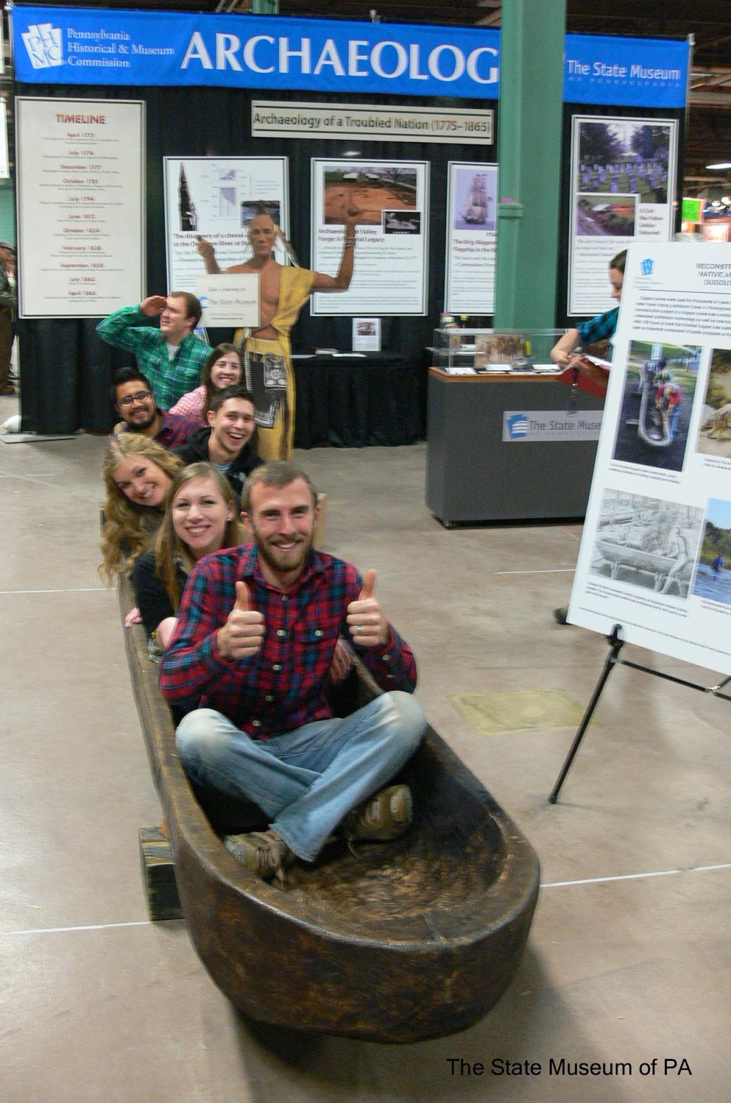
Visitors to the Section of Archaeology’s Farm Show exhibit.
Photo: PHMC/The State Museum of PA

Contacting Us

In addition to roles with exhibits and the SHPO, our staff may receive multiple inquiries from researchers, educators or the general public during a single week. The archaeology department does its best to answer questions in a timely manner. If we are not able to assist with an inquiry, the staff will refer the question to an individual whom we think may be better able to assist.
Frequently, questions concern artifact identification. Our staff is most capable of answering questions about artifacts found in Pennsylvania and the Mid-Atlantic region. At minimum, a good quality photograph with a scale should be included in the inquiry, but remember, identification via photograph is not always possible. If scheduling allows, our staff is willing to identify artifacts in person at our offices in downtown Harrisburg.


A copper adze that was brought to the archaeology staff for identification- there are no other items like this in our collections, making it an especially intriguing artifact.
Photo: PHMC/The State Museum of PA

Other common questions come from individuals wishing to use the archaeology collections for research. Many journal articles, master’s theses, and Ph.D. dissertations have been produced from research conducted using the State Museum of Pennsylvania’s historic and prehistoric archaeology collections.  Listed below are just a few of the many publications.

Esarey, Duane
2013 Another Kind of Beads: A Forgotten Industry of the North American Colonial Period. Unpublished Ph.D. dissertation, Department of Anthropology, University of North Carolina at Chapel Hill. Published in American Archaeology, Vol.18, No.1 spring 2014

Lauria, Lisa
2004 Mythical Giants of the Chesapeake: An Evaluation of the Archaeological Construction of “Susquehannock”. Journal of Middle Atlantic Archaeology 20:21-28

Mitchell, Seth
2011 Understanding the occupational history of the Monongahela Johnston Village Site Through Total Artifact Design. Unpublished Master’s thesis, Department of Anthropology, Indiana University of Pennsylvania, Indiana, Pennsylvania.

Orr, David G
2003 Samuel Malkin in Philadelphia: A remarkable Slipware Assemblage. Ceramics in America 2003 pp. 252-255 (http://www.chipstone.org/article.php/97/Ceramics-in-America-2003/Samuel-Malkin-in-Philidelphia:-A-remarkable-Slipware-Assemblage)

Occasionally, our staff will receive a request for public outreach. In October of this year, a request of this nature sent two staff members to the Upper Adams Middle School in Biglerville, PA to speak to 7th grade students studying ancient history. For occasions such as these, our staff uses a display board, a photographic slideshow and an assortment of prehistoric and historic artifacts to provide students with an overview of what it means to be an archaeologist and why archaeology matters. These experiences can be extremely rewarding for both the students and the staff. Public outreach plays an important role in meeting the educational goals of the museum.

Archaeology Curators Liz Wagner and Melanie Mayhew display artifacts for students of ancient history
Photo: Brenda Robinson

In addition to special requests for public outreach, archaeologists at the state museum participate in special programming at The State Museum. During the summer of 2015, staff members were on hand every Thursday afternoon in the Nature Lab on the third floor of the State Museum to offer insight and answer questions on a broad range of archaeology subjects including prehistoric tool making, clay pottery and the ongoing research of prehistoric stone axes, among other topics.


These are just a few of the many functions served by the archaeology curators at the State Museum of Pennsylvania.


For more information, visit PAarchaeology.state.pa.us or the Hall of Anthropology and Archaeology at The State Museum of Pennsylvania .

Friday, December 18, 2015

Behind the Scenes at The State Museum – Mapping the archaeological record at Fort Hunter


To continue our discussion about Fort Hunter data collection, processing and usage we will take a look at one of the most important factors in understanding and preserving an archaeological site. This factor, as is commonly stated in the real estate industry is, “location, location, location”. In order for archaeologists to understand the landscape of an archaeological site we must know where everything is in location to one another both horizontally and vertically. The reason it is so important to record the location of artifacts, features and structures, is that once they are removed from the ground there is no way put them back in their exact place again. In addition, maps depicting the exact location of different types of artifacts are necessary to identify artifact patterning and activity areas. The excavation methods employed by trained archaeologists insure that the entire archaeological record of a site is properly recorded during excavation as archaeology is a destructive science.
 
In order to preserve this locational information, sites such as Fort Hunter, are excavated based on a grid set from our datum (a known fixed point). This allows archaeologists to go back to a site, whether it is from year to year or twenty years from now, and re-establish the grid. With good documentation and a re-established grid, archaeologists can determine what areas had been previously excavated. The grid also provides the horizontal locational information of artifacts and features that have been removed from that area. At Fort Hunter our grid is in 5 by 5 foot square increments, which is termed as a unit. We name our units using the northing and easting (for example N90E10) of the southwest corner of a square. This designation allows us to easily reference that unit and keep track of the artifacts or features.
   

Overview of Fort Hunter excavations with stakes and string line indicating the grid, Fort Hunter 2007

Once a grid is established, we begin excavating units in levels in either arbitrary levels of a predetermined measurement (for example 3 inches or 5 centimeters etc.) or based on soil layers, which are indicated by changes in soil color and texture. The layers are often given an alpha designation based on the soil type. Identifying the same types of soil throughout the grid allows us to see how the soil layers slope and change over the landscape. These anomalies can indicate different geologic/climatic processes as well as point to the activities of people on the landscape. Within these natural layers, we then excavate in arbitrary levels. These levels and layers are measured below the set datum elevation, which provides the vertical location information of the artifacts found within that level.

As mentioned in our last blog, “…unique catalog numbers are assigned to each provenience.” The provenience mentioned here is the locational identity of the artifacts based on the horizontal and vertical measurements discussed above. It is with the locational information and the well-developed catalog that we are able to know how the artifacts and features are related to one another.
Now that we have explained how we use the grid, we can look at how we layout the grid, take measurements and how we manipulate the data in the lab. The basic idea of establishing a grid is to create accurate 90 degree angle squares and in order to do this archaeologists use a transit, tape measures and some basic geometry. A transit is an instrument that sights straight lines and different angles. The transit is also used with a stadia rod to measure the depth of a level.

Staff member using transit, just beginning to set up grid, Fort Hunter 2010

Today we use a newer technology called a total station. A total station is an electronic transit which can also sight straight lines and angles as well as use a laser and prism to collect precise horizontal and vertical measurements of a point on our grid. Using the Top Con Data Collector (handheld attachment to the total station), we are able to easily store and look up point information while in the field and also download and convert the data into a spreadsheet format.

Staff member using Top Con total station, Fort Hunter 2014

Staff member holding prism to take measurements using total station, Fort Hunter 2014

Example of collected data in spreadsheet format

With the data collected, we are able to then create useful maps, which allow us to analyze the relationship between features, structures and artifacts. It is also possible to use unit and artifact data to create distribution maps. Common programs used to create such maps include Golden Software’s Surfer and Autodesk’s AutoCAD.

Example of a feature map, showing relationship of several different features


Example of an artifact distribution map

Example of a profile map

With today’s technology, and the detailed information we collect, there are many different mapping options including those above as well as the ability of creating 3-D images. Knowing the relationship of artifacts and features on the landscape provides the foundation that archaeologists use to develop explanations for how past humans were living on and using the landscape. Creating these maps provides a useful visual comparison of how features, artifacts and structures are placed on the landscape. Finally, maps also provide a great way to interpret an archaeological site and how we present different ideas of the past to others.  

We wanted to take a moment to remember a longtime volunteer, Sheila Dunn. Sheila was a dedicated volunteer who put a lot of time and effort into collecting data and creating Fort Hunter maps for us. Using her training and past experience in watershed surveys she was always ready and willing to help out in any way and put in great effort to create some of our first maps of the Fort Hunter excavations. Thank you, Sheila.  

Sheila Dunn


We hope to see you all in the new year at the 100th anniversary of the Pennsylvania Farm Show running from January 9-January 16, 2016. Look for us in a new location this year directly off of the Maclay Street entrance near the children’s carousel. From all of us in the Section of Archaeology at The State Museum of Pennsylvania - Have a happy and safe holiday!

For more information, visit PAarchaeology.state.pa.us or the Hall of Anthropology and Archaeology at The State Museum of Pennsylvania .

Friday, December 4, 2015

Behind the Scenes at The State Museum—Processing the Fort Hunter Collection What happens after the field work is done?

Our last blog about Fort Hunter highlighted the ongoing archival research staff archaeologists’ conduct to inform how we interpret the results of each year’s excavation which aids in directing our plans for future investigations.  Over the next few postings we are going to continue to discuss what happens with Fort Hunter artifacts and excavation documents between field seasons.
For every day of investigation at a well-defined archaeological site, roughly seven days are required to fully process and conserve the artifacts and archive the associated field documentation. This is a general rule of thumb that many professional archaeologist use to estimate time in preparing budgets for archaeological investigations. The laboratory time needed varies to a degree depending on quantities and types of artifacts, the extent of field records, and the numbers of people working with the collection, but on average the ratio of 1:7—length of field season to laboratory processing time—holds true.

 Artifacts laid out on trays to clean and label, Fort Hunter 2015

The 2015 Fort Hunter field season was conducted for a span of 25 days, with over 12,000 artifacts recovered, 133 proveniences documented (excavation unit levels dug and subsurface features identified, etc.), and 470 digital photographs taken. Based on the ratio of 1:7, the estimated time for a single person to fully process the collection would be around 175 days or about seven months working five days a week. This estimate projects an April completion date of the following year to fully inventory, curate and archive collected artifacts and documents for any given fall season. Luckily we have two staff members in the archaeology lab and a rotation of several dedicated volunteers who greatly assist with the cleaning and labeling of artifacts.  Working together we are able to generally complete the lab processing of Fort Hunter annual collections by early January, while juggling other projects and responsibilities.


 Volunteer rinsing historic artifacts washed with a Sonicor industrial cleaner

As with any collection that is processed in the lab, the initial steps are to organize and record the provenience information from field bags through the preparation of a digital inventory; and stabilize the artifacts through washing, dry brushing or other conservation techniques as needed.


Excerpt from 2015 Bag Inventory

The bag inventory is then used to assign unique catalog numbers to all proveniences represented in the artifact collection. Cleaned artifacts that are at least a square inch in diameter and are material types that can be safely treated with a reversible acryloid basecoat (e.g. - most historic and prehistoric ceramics; prehistoric stone tools; historic glass and brick) are labeled with their site number— a trinomial abbreviation developed by the Smithsonian which includes the state, county, and site information—and their designated catalog number in archival ink. Labels are then sealed with a clear topcoat to ensure longevity for long-term curation.


Staff Member basecoating terracotta pots and redware pottery sherds, Fort Hunter 2015

Fort Hunter’s site number is (36Da159). When ordered alphabetically, Pennsylvania falls 36th within the 50 States; Da is the abbreviation for Dauphin County; and Fort Hunter is the 159th site recorded in the Commonwealth’s archaeological site survey file in this county. (Click the provided link for more information about the Pennsylvania Archaeological site survey (PASS) for Dauphin County.)


 Volunteer labeling medicine bottle from tray of glass artifacts, Fort Hunter 2015

It may seem excessive to label the copious amounts of bottle glass, brick and other materials that are recovered from Fort Hunter every year, but it is well worth the time investment. The most valuable aspect of each artifact recovered is where it was located in relation to other artifacts and features on the site. This is often referred to as an artifact’s context, and is what ultimately allows archaeologist to interpret past human behaviors. Labeling artifacts with this coding system allows us to quickly know where they were recovered from, and is a safe guard against losing this information when objects are frequently pulled out of storage for further analysis.


Excerpt of Final Artifact Inventory, Fort Hunter 2014

The final steps in the artifact curation process are to add a description of each artifact or group of like artifacts into the digital inventory by catalog number, and bag and box them carefully to insure their preservation for long-term curation. This is all done in a systematic manner so that any given artifact can be easily accessed and utilized by future researchers. Maintaining a complete inventory and well organized collection for Fort Hunter year to year is particularly important because we continue to learn new information with each field season. Our interpretations continue to expand and refine as we delve further into the historic record through archival research and as our field investigations contribute further insights into material culture practices that both validate the existing historic record and broaden its scope of perspective.


Staff Member pulling artifacts from collections storage to compare findings from a previous Fort Hunter investigation year

The State Museum’s Section of Archaeology is the principal repository for archaeological collections in Pennsylvania and maintains over 7 million artifacts and associated documents. Fort Hunter field documentation and digital photographs are also archived in the Section’s county files and on a secure server with backup contact sheets and logs. These documents are constantly referenced to draft reports and articles; to create maps; to relay information in public and professional forums through presentations, exhibits, blog postings and other media outlets; and to plan further investigations. Each piece, from the artifacts recovered to field records and photographic documentation, fits together to reconstruct the story of Fort Hunter’s past. When the field work is done, we rely on sound conservation practices and accurate digital records to preserve access to Pennsylvania’s rich archaeological record for generations to come.


Staff Member searching county files for project documents

Our next blog will delve deeper into an important aspect of reconstructing and preserving archaeological contexts at Fort Hunter through digital mapping.

Special thanks to all the 2015 volunteers and interns that have greatly contributed to Archaeology Month programs this fall and post-excavation processing of the Fort Hunter collection. Thank you for preserving our past for our future—Andi B.; Jerry B.; Mary C.; Toni and Andy D.; Phil F.; Erin, Kaela and Keara F.; John G.; Keenan H.; Jonathan K.; Ruth K.; Linda L.; Brad M.; Seth M.; Fred M.; Paul R.; Wendy S.; Chriss S.; Wes S.; Clydene, Stephanie and Steve S.; Andy S.; Merikay W.  
 

If you are interested in learning more about archaeology methods and Pennsylvania Prehistory check out First Pennsylvanians: The Archaeology of Native Americans in Pennsylvania available for purchase online and at The State Museum gift shop. 

For more information, visit PAarchaeology.state.pa.us or the Hall of Anthropology and Archaeology at The State Museum of Pennsylvania .

Friday, November 20, 2015

New Perspectives on an Old Subject: Trade and Native American Relations at Fort Hunter

Although the subject of Fort Hunter has been covered a number of times in the TWIPA blog, research conducted over the past year indicates that there was more going on in the area of Fort Hunter than was previously known. Prior to becoming the French and Indian War post of Fort Hunter, this area was known as “Chambers’ Mill” or “Chambers at Paxtang”, named for its early occupants, brothers Robert, Joseph, James, and Benjamin Chambers.  Eventually, the brothers moved across the Susquehanna River except Joseph who operated a grist mill as well as possibly a gunsmith/blacksmith shop on the property.
1755 Evans Map Showing the Location of Chambers’ Mill North of the Kittatinny Mountain

Chambers’ Mill appears to have become a widely-known location utilized as a gathering place starting soon after the Chambers’ initial settlement. In 1744, the murder of several white men, including the trader John Armstrong, by the Indians occasioned a meeting of John Harris and other locals “at the House of Joseph Chambers in Paxton” who “there Consulted to go to Samokin [Shamokin], To Consult with the Delaware King & Secalima [Shikellamy] & their Council”. 
Again in 1744, a council for the Lancaster Treaty brought a large number of the Six Nations natives to the area to consult with the governments of Pennsylvania, Maryland, and Virginia. Conrad Weiser met these Indians and brought them through Paxtang on their way to Lancaster City. On June 16th, 19th, and 20th he purchased supplies at Chambers’ and from Simon Girty, Sr., an unlicensed trader who is known to have traded at Chamber’s Mill. Weiser’s journal indicated that he purchased “three hundredweight of flour from Joseph Chambers and five Shillings worth of Bread and Milk of Simon girty” as well as a steer, rum, and tobacco to feed and entertain the Indians.
In the summer of 1747, Weiser, passing through the area on his way north, “found Shickelimy at the house of Joseph Chambers, in Paxton, with two of his sons and a man of note from the Canickquon Country.” Weiser “stayed two days and two nights at Joseph Chambers with the said Indians, discoursed with them, and I entertained in the best manner I could”.  Other noted visitors to Chambers’ Mill in the 1740s included the Indian missionaries David Brainerd, Anton Schmidt, and Bishop John Christopher Frederick Cammerhoff.
Other than foodstuffs, alcohol, and tobacco, it is unclear what was being traded at Chambers’ Mill but it is likely that Joseph and his son James were also conducting trade. Following James’ death in 1763, an inventory of his belongings listed tomahawks, brass kettles, cloth and thread, matchcoats, Indian shirts, handkerchiefs, “2 Silver Hair plates” and “2400 Black Wompum” indicating the likelihood that he was engaging in trading activities with the natives. In 1764, a letter written from Fort Hunter to James Burd references Dennis McCormick’s desire to “dispose of all ye Hyds” that McCormick has at the fort. This indicates that animal skins were possibly being traded for goods here. 
A number of other trade locations were available in the vicinity of Chambers during this period. John Harris at Harris’ Ferry (later Harrisburg) and John Carson were located just to the south, while the Armstrong’s and Thomas McKee had trade posts to the north along the river. Whether it was to trade, to bring grain to the mill, to attend a council, or to visit the smithy for gun repairs, it is clear that something was drawing the natives to visit Chambers’ Mill. On his 1748 trip to Shamokin, Bishop Cammerhoff notes that he and his companion overtook two Indians in the woods “who lived fifty miles above Shamokin” who were “returning from Chamber’s Mill”, indicating the distances that some went to get to the mill location.                                             
It is likely that Samuel Hunter, for whom the fort was known, was also trading with Indians at the property. A trade license was issued to Hunter for the year 1766 that gave him “Licence to trade with the Nations or Tribes of Indians, with whom his Majefty is connected, and who live under his protection…” A licensed trader was required to give bond of £100 at a quarter session of county court, allowing him to set up a legal trade at government forts or posts. Although 1766 was the only year a license is known to exist for Hunter it is possible he was trading with Indians at Fort Hunter during the war.
1766 Trade License for Samuel Hunter (PHMC Archives) 

 Although no definitive account of the types of goods being traded at Chambers’ Mill has yet been discovered, a number of artifacts recovered from the site indicate the possibility of a link to native visitations. Eighteenth century glass trade beads and cut scrap brass, prized by the Indians for ornamentation, have been found during excavations. In 2015, four glass trade beads were recovered from newly-opened test units on the east side of the back porch, as were fragments of brass and brass ornaments.  
Trade Beads Recovered from 2015 Excavations at Fort Hunter (Photo: PHMC Collections)


Glass Beads and Scrap Brass from Fort Hunter Excavations (Photo: PHMC Collections)

Gun parts recovered from the site could be associated with military activities at the fort but may also reflect pre-war use of the smithy and could represent native weapons brought in for repair. This could be one reason that Indians were traveling long distances to visit the site, as the Moravian smithy at Fort Augusta was not constructed until the winter of 1747-48. Other items that have been found at the Fort Hunter excavations, such as knives, combs, scissors, buttons, straight pins, and mirrors could represent trade goods as easily as objects associated with the military occupation or even household goods of the Chambers or Hunter families.

More documentary research and comparison of the collection will need to be undertaken in order to detail the nature of the objects recovered from Fort Hunter. A more careful inspection of the entire collection may reveal that objects thought to have been associated with the fort occupation are possibly instead related to trade activities. Through such work it is hoped that a better understanding of the early trade and Indian relations at this site will emerge.


References:
 Cammerhoff, Bishop John Christopher Frederick and John W. Jordan                                        1905    “Bishop J.C.F. Cammerhoff’s Narrative of a Journey to Shamokin, Penna., in the Winter of 1748”. The Pennsylvania Magazine of History and Biography, Vol. 29, No. 2, pp. 160-179. 
Evans, Lewis
1755    A General Map of the Middle British Colonies in America. Evans: London.

Fort Hunter Archives
2015    Private collection of photos and documents at Fort Hunter Park.

McCormick, Dennis
1764    Letter Dennis McCormick to James Burd, Fort Hunter 28th Nov. 1764. American Philosophical Society, Burd-Shippen Collection, I-Correspondence, Box 4

Shirai, Yoko
1985    The Indian Trade in Colonial Pennsylvania, 1730-1768. Ph.D. Dissertation, University of Pennsylvania. UMI Dissertation Services.

Runk, J.M. & Company
1896    Commemorative Biographical Encyclopedia of Dauphin County, Pennsylvania. Chambersburg: J.M. Runk & Company.

Rupp, I. Daniel
1846    The History and Topography of Dauphin, Cumberland, Franklin, Bedford, Adams, and Perry Counties.  Lancaster: Gilbert Hills.

Wallace, Paul A.
1996    Conrad Weiser, 1696-1760, Friend of Colonist and Mohawk. Lewisburg: Wennawoods Publishing.


For more information, visit PAarchaeology.state.pa.us or the Hall of Anthropology and Archaeology at The State Museum of Pennsylvania .

Thursday, November 12, 2015

Parking Information for the Workshops in Archaeology
Saturday, Nov. 14th, 2015

Due to the Grand Review procession through downtown Harrisburg on November 14th in observation of Veterans Day and the 150th anniversary of the end of the Civil War, the parking situation for our Workshops in Archaeology has changed.

Parking will be available in two locations; both are approximately 5 blocks from the State Museum of Pennsylvania:


220 South St.
Harrisburg, PA
Note: parking fees have been waived for the Grand Review events taking place on Saturday.

The parking lot located at 916 N. 6th St. (across N. 6th St. from Messiah Lutheran Church’s parking lot)
Directions from the Harvey Taylor Bridge:
Turn Left onto Commonwealth Ave. from Forster St.
At Boas St. (the first intersection), take two immediate lefts (wide U turn), the church parking lot should be on your left and the 6th St. parking lot (with a low brick wall) on your right.

Directions from southbound travel on N. 7th St.:
Turn right onto Boas St.
At the first intersection, take the second left.

The parking lot (with a low brick wall) will be on your right.


For more information, visit PAarchaeology.state.pa.us or the Hall of Anthropology and Archaeology at The State Museum of Pennsylvania .

Friday, November 6, 2015

Workshops in Archaeology 2015

the process and results of water separation at an archaeological site

Much of what we know about Native American plant husbandry is the result of many years of specialized investigation through the archaeological recovery process of separating carbonized debris from pit soil via water immersion. This process is called flotation the principal method used by archaeologists and paleo-ethnobotanists to recover plant parts, especially seeds and other small fragile remains from archaeological contexts. Through flotation, specimens are recovered, identified and studied to better understand the subsistence behaviors of the people who consumed them. Additionally, starch and pollen grains and phytoliths are minute residues associated with prehistoric diet. Thus, through a careful detailed study of these plant related components, hidden information is revealed relating to human diet.  On a regional, level this research has broad implications that have the potential to greatly enhance our understanding of cultural adaptations and plant use/consumption of prehistoric native groups who once occupied the Pennsylvania landscape.

various starch grains from archaeological sites

At first blush growing crops from weeds may seem a weird concept but cultures around the world have been doing just that for thousands of years. Take for example the food patterns of early Meso-American societies where various strains of grass, by way of eco-human modification and natural selection developed into the primitive form of maize called tseosinte. Over time this crop food, became the flint and dent varieties of maize. Along with beans and other Mesoamerican derived plant foods likely spread into the Mississippi Valley and on to other parts of North America at an early period where they became valuable food products in the Native American and Euro-American diet.

squash phytoliths

Gourds were grown in the central Mississippi valley around 4500 years ago and gourd rinds dating approximately to this period have been recovered from archaeological contexts in the central Susquehanna valley at the Memorial Park Site. Certain weed seeds carefully selected for their robustness and nutritional qualities were replanted setting the stages for incipient Eastern North American horticulture. Though archaeologically unknown or rarely identified for much of Pennsylvania other weed crops were Amaranthus a.k.a. pigweed ,Chenopodium a.k.a. goosefoot, Iva a.k.a. marshelder and Helianthus a.k.a. sun flower among others.

multiple pollen grains imaged under SEM scope

Horticulture or garden farming played a significant role in the sustainment of a dependable food base. Climate fluctuations occurring at certain periods in human prehistory/history, caused by uncontrollable rises and declines in solar activity, volcanic eruptions and trade wind temperatures, bore directly on ocean current patterns. Some or all of these factors were contributory to the Little Ice Age and the Neo-boreal climatic period between 1350-1850 AD. Their lasting effects were felt in many parts of the world until the early 19th century when conditions again improved.

Until the arrival of domesticates with modifications in the environment human plant food consumption likely did not change much though some plant foods were only available seasonally. Foods such as berries and a wide range of nuts only ripened during certain times of the year (i.e. the fruiting season of summer and the nutting season of late autumn). In their absence edible parts of soft stemmed plants that emerged in early spring were processed and eaten along with roots and tubers from mud banks and wetlands. The latter of which were accessible over much of the year. Some of these plant products thus harvested were eaten directly or stored for later consumption added variety to the daily menu of native people.

The appearance of maize (circa 800 AD) and beans (circa 1300 AD) on Pennsylvania’s prehistoric landscape significantly contributed to changes in Native American demographic patterns. Small habitation sites grew into large fortified settlements supporting many people. Surrounding many of these settlements were extensive agricultural fields where corn, beans and pumpkins were grown. For much of Pennsylvania this subsistence strategy lasted until the system collapsed and many groups were dispersed in the mid-17th century when foreign diseases arrived and Europeans focused their economic pursuits on land acquisition and the extraction of native resources. By the early 17th century elements of the native diet were adopted by European immigrants and their presence can still be seen on the modern day dinner plate.

This has been a brief introduction on the use of plant foods in the Keystone State from “weed seeds to garden seeds”. The 2015 Annual Workshops in Archaeology Program is only a week away. This year’s theme is a topic of wide interest to many Pennsylvanians beyond the archaeo-botanical community. Experts with special fields of interest will be presenting and you can view the program by clicking on the program banner to the right at the top of this post. We hope to see you at the workshops on November 14th.


For more information, visit PAarchaeology.state.pa.us or the Hall of Anthropology and Archaeology at The State Museum of Pennsylvania .

Friday, October 23, 2015

Archaeology at Ephrata Cloister


With this year’s field season at Fort Hunter Mansion and Park behind us, we continue our look back at archaeological projects conducted by The State Museum of Pennsylvania over the course of the last half century. This series is intended to dove-tail with the broader celebration of the 50th anniversary of the construction of the William Penn Memorial Museum building in Harrisburg, which houses The State Museum of Pennsylvania and the executive offices of its parent state agency, the Pennsylvania Historical and Museum Commission.

excavating a post mold feature at Ephrata Cloister (36La981)


A number of posts in this series previously detailed the excavation of stratified prehistoric sites in advance of large, federally funded or permitted development projects, such as Sheep Rock shelter (36Hu1) for the Raystown Reservoir (Army Corps), and 36Da50 in anticipation of the construction of the Three Mile Island nuclear reactor (FERC). This week, the focus will be on the decade long historical archaeology project that took place at Ephrata Cloister, an 18th century religious commune in Lancaster County, now a popular historic site that has been owned by the Commonwealth since 1941.

WPA poster for Ephrata Cloister


The formation of the Ephrata Cloister community was the direct result of a founding policy of William Penn’s nascent colony, that of religious tolerance. Nowhere else in colonial America were the conditions such that a social experiment like that of the Cloister was possible, thanks to Penn. Political and religious upheaval, and the accompanying economic hardships faced by marginalized groups throughout Europe in the late 17th century, spurred many to seek a new beginning across the Atlantic. Such was the case with Conrad Beissel, a German immigrant who would come to settle in Lancaster County around 1730 seeking a more meaningful spirituality through solitude and piety.

The charismatic Beissel soon found himself the leader of a small, but industrious group of like-minded people that would comprise the Cloister community. While spiritual purity was the primary focus of the cloister’s celibate brothers and sisters, some of the activities they engaged in include agriculture, print making, fraktur art, and among other industries, the construction of large dormitories and prayer houses, some of which survive today and have become icons of this National Historic Landmark.

at left, sisters' dormitory (1743) and right, prayer house (1741)

In the late 1980s site administrators expressed concern that adequate measures had not been implemented to protect the massive wooden structures, some of them at this point approaching 250 years old, from the threat of destruction by fire. Steve Warfel, then Senior Curator of the Section of Archaeology at The State Museum of PA, was contracted to perform an archaeological survey of the proposed fire suppression line across the property in an effort to identify any significant subsurface features relating to the site’s early religious commune activities.

large cellar on Mt. Zion, excavated in 2001

 From that initial scope of work would emerge an annual historical archaeology field school, conducted in the months of June and July, which instructed dozens of college students in the methods of excavation, recordation and artifact identification. Over the course of eleven seasons, hundreds of thousands of artifacts were recovered, and several no longer extant buildings were relocated on the landscape, enhancing and enriching the story of the Cloister (including its time as a hospital during the American Revolution), and sometimes challenging long held assumptions about the behavior of its inhabitants.

reconstructed storage crocks and table wares from the 1995 field season


top row, left to right: medicine vial fragment, english gun flint, two pieces of lead printers type
middle row: musket balls, french and english flint fragments
bottom row: medicine vial fragments


In an important final step after each season, Warfel published his findings in accessible booklets (still available at the Cloister gift shop) detailing the remains of structures discovered and their associated artifacts, in order share insights gathered with parties interested in this special piece of colonial American history.


This week’s post serves as a mere introduction to the Cloister and a number of interesting facets about its members and their interactions with each other and with non-members locally and regionally. Outside of Warfel’s archaeological booklet series, numerous books have been written about Ephrata, If your curiosity has been piqued, please refer to the suggested reading list below to dig a little deeper.

Bach, Jeff. Voices of the turtledoves: the sacred world of Ephrata. Penn State University Press, 2003

Benson, Cynda. Early Illuminated Manuscripts from the Ephrata Cloister. Northampton, Mass.: Smith College Museum of Art, 1995.
Garvan, Beatrice B., and Charles F. Hummel. The Pennsylvania Germans: A Celebration of Their Arts, 1683-1850. Philadelphia: Philadelphia Museum of Art, 1982.
Lamech and Agrippa. Chronicon Ephratense: A History of the Community of the Seventh Day Baptists at Ephrata. New York: Lenox Hill Publishing, 1972.
Reichmann, Felix, and Eugene E. Doll. Ephrata as Seen by Contemporaries. Allentown: The Pennsylvania German Folklore Society, 1953.
Sangmeister, Ezechiel. Leben Wandel: Life and Conduct of the Late Brother Ezechiel Sangmeister. Ephrata: Historical Society of the Cocalico Valley, 1979-1985.
Secor, Robert, ed. Pennsylvania 1776. University Park: The Pennsylvania State University Press, 1975.
Warfel, Stephen G. Historical Archaeology at Ephrata Cloister. Harrisburg: Pennsylvania Historical and Museum Commission, 1993-2003.
Weiser, Frederick S., and Howell J. Heaney. The Pennsylvania German Fraktur of the Free Library of Philadelphia. Breinigsville: The Pennsylvania German Society, 1976.


For more information, visit PAarchaeology.state.pa.us or the Hall of Anthropology and Archaeology at The State Museum of Pennsylvania .

Friday, October 9, 2015

Summary of the 2015 field season at Fort Hunter


At the beginning of the 2015 field season, we had 3 goals for the Fort Hunter excavation: investigate the icehouse to verify its function; to clean up and clarify the foundation east of the icehouse believed to be the octagon shaped smoke house; and to open new excavation units by the mansion to seek out any evidence of the block house beyond the foot print of the mansion.

Screening with a little help from our friends

As usual, our investigation plans for this year were greater than our staff and loyal volunteers could handle although we made a valiant try. Our screens were humming, producing over 12,000 artifacts but the opening of new units or features was not as extensive as we had planned. In the block east of the milk house (see below), we were able to expose the complete foundation of the building we think is the octagon shaped smoke house referenced in an 1828 account, unfortunately most of the other features in this excavation block were not tested. We discovered that the south and east walls of the stone foundation were in much better condition than the north wall which appeared  to have been disturbed or “robbed”.

The octagon smoke house with a circular foundation and the attached structure containing the stove to introduce the smoke.

We troweled around Feature 110, situated in the middle of the circular foundation and found a charcoal/organic stain covered with a mix of topsoil and subsoil (“A” & “B” horizons). It appears that the dark stain was in the bottom of a hole and covered with fill. The smoke for this octagon shaped smoke house was reportedly introduced from a stove outside of the building. This charcoal stain may be the remains of a square shaped smoke house that preceded the octagon in which the smoke was generated from inside. A partial excavation of this feature last year produced a few possible 18th century artifacts and will require careful study next year. 

West side of milk house illustrating the exposed foundation

Our investigation of the structure formally known as the “icehouse” and now labeled as the milk house was significantly more rewarding. Our first indication that it was not an icehouse came early in the season while excavating the deeply stratified prehistoric horizons west of this structure. These investigations revealed that the foundation was less than six feet deep which did not agree with the historic account that describes the icehouse as over 15 feet deep.

Jim Herbstritt working inside the milk house

 Following the removal of the wooden floor boards and exposing a tightly paved brick floor, followed by auguring beneath the brick, it turns out the brick was laid on a thin disturbed soil layer followed by the natural soil profile of Pleistocene sands and cobbles. In addition, a closer look at a recessed hole in the west wall revealed that it had been patched from the outside with cement – probably placed there when the building was upgraded in the 1970’s.

Auguring inside the milk house

In our re-analysis of the building’s function, it’s placement over the edge of the well foundation is significant. It is hypothesized that water was pumped from the well, through the hole in the west wall and into wooden containers that held cans of milk, cider or other liquids to be cooled. These were periodically emptied and the running water drained out the back of the building.

The interior drain in the milk house

Finally, we removed several rows of brick from the floor along the west wall of the milk house and exposed the interior builder’s trench and a disturbance in the southwest corner. The well is situated just outside this corner and the excavation of this disturbance may date the well, date the milk house and elucidate the functional relationship between these two structures. Dating these structures is extremely important for reconstructing the arrangement of buildings and their functions during the early McAllister occupation. Next year, we will probably excavate the entire builder’s trench and, if necessary, the disturbed soil under the brick floor to recover a datable assemblage of artifacts. Currently, we only have an 1828 reference to the well, milk house and octagon shaped smoke house. However, we believe the well is the oldest of these structures and probably was one of the first structures built by McAllister or possibly Mr. Hunter at an even earlier date.
The drain on the exterior of the north wall

Mary Clyne developing a scale drawing of the west wall

Now that the milk house has been completely exposed on the interior and the bottom of the exterior exposed on two sides, our intern from Elizabethtown College, Mary Clyne, is completing scale drawings of the walls and floor. These will be digitalized to accurately document the structure and hopefully clarify how it functioned.

Mary Clyne working inside the milk house

Porch Trench

The Excavation along the porch brought us back to the 18th century occupation and the investigation of frontier life in Pennsylvania. Four (5x5 ft.) units were placed along the brick porch of the McAllister mansion. The first soil layer was the typical 19th and 20th century “A” horizon that we identify as Strat 1 and is found across the site in this area of the yard. Below this soil, a lighter brown “A” horizon was uncovered that we have labeled Strat 2. These two soil strata were identified during our first season at Fort Hunter and they are found south of the milk house and for the most part are absent in the excavation units east and west of the milk house. Strat 2 lies directly above the “B” horizon that is designated Strat 3. Although 19th century and non-diagnostic artifacts such as rusted metal, nails and bone dominated the collection, more 18th century artifacts were recovered from these units than all 15 units opened west of the milk house. The list includes gunflints of French and English flint, musket balls, tin-glazed earthenware, brass scrap and most interestingly, several early 18th century glass trade beads. There are references in the historic record that Mr. Hunter was trading with the Indians and these artifacts hwlp support the historic account. 
We were unable to complete the porch trench and did not reach the “B” horizon subsoil although a transitional “A”/”B” zone was exposed. Most of Strat 2 is deeper in the porch trench than elsewhere and it may represent a large depression or hole in the 18th century surface. Next year, we will continue in this unit and expand it to the north and east.
Both historic and prehistoric archaeology tests hypotheses and explanations of past cultural behavior. In addition, historic archaeology is a process for testing and verifying the historic record. To a degree, it is a more objective examination of history than documents alone. This season, we were able to correct the historic record and develop a more accurate description of the McAllister functional arrangement of buildings. As usual, we resolved some issues but discovered new ones.
To summarize, next year we will continue working inside the milk house to date this structure and better understand its relationship to the well. We will expand our excavation along the porch as this area contains a high density of 18th century artifacts that may relate to the fort site or either the Hunter or McAllister occupations. We will also further define the features around the smoke house.
We are starting to get a better picture of the cultural landscape of Fort Hunter. Mr. Hunter and Mr. McAllister were true entrepreneur and we are beginning to uncover the early projects that made them and their families successful.


Finally, our other goal at Fort Hunter is to show the public how field archaeology is conducted. Towards that end we interacted with over 2700 visitors this season. 

For more information, visit PAarchaeology.state.pa.us or the Hall of Anthropology and Archaeology at The State Museum of Pennsylvania .