
A
simulated archaeological excavation can be defined as an experimental project
organized by a classroom teacher that has an educational goal of reconstructing
human behavior using archaeological techniques (Chiarulli et al. 2000). Students can learn about archaeology and
archaeological methods in a classroom setting but there is nothing like a
hands-on experience offered by a simulated excavation. The Section of
Archaeology at the State Museum has been working with Susquehanna High School
for over five years on a very popular forensics archaeology project and now
another high school is getting involved in archaeology as a way to enhance the
educational experience of their students. As part of Mr. Daniel Reilly’s AP World History class, 13 students at Cedar Cliff High School
will be spending two weeks this May learning about and doing archaeology at a
simulated site near the sports stadium. For these students, it becomes
experiential learning. Their participation in this archaeological excavation is
something they can appreciate and they will be able to call on this newly
acquired knowledge for the rest of their lives.

The
field work actually began earlier this spring, when Mr. Reilly (assisted by
several other teachers who were intrigued with the project) created a mock
archaeological site by placing artifacts in the ground. They buried artifacts
that represented a prehistoric camp site including a fire-cracked-rock hearth
with charcoal and food remains situated next to a pile of flakes from the
production of stone tools (the debris created by an actual flint knapping
demonstration). In the corner of the site, three burials were placed; not actual
human remains, but deer skeletons aligned in a human-like fashion – thus
creating the “deer people”! Mr. Reilly registered the site with the
Pennsylvania Archaeological Site Survey and was assigned the number of
36CU0210.

The
students began with several days in the classroom where they were taught the
difference between archaeology and paleontology; that archaeology was a
subfield of anthropology – the study of human cultures; the nature and
significance of stratigraphy; and the importance of archaeological context or
the location of the site and the three dimensional location of the artifacts
within it. They were also treated to a
flint knapping demonstration where they were offered the opportunity to try
their hand at chipping stone into tools. At the end of this class, they hafted
the flakes onto handles to experience actually using stone tools.


Mr.
Reilly holds an MA in Archaeology from Queen’s University of Belfast in
Northern Ireland where he has excavated Bronze Age, Iron Age, and Medieval sites. He also spent four years in compliance
archaeology all along the Mid-Atlantic US before becoming a teacher. He was
very excited about this project but it required a lot of planning and effort on
his part. Working with a limited budget, he received assistance from KCI
Technologies and the State Museum of Pennsylvania, Section of Archaeology for
shovels, buckets, trowels, brushes, tapes and screens. Maybe next year, someone
would be willing to donate these materials as a permanent contribution to the project.
He also had to manage a crew of 13 inexperienced but eager students and luckily
he received help from fellow teachers and the archaeology staff at the State
Museum.


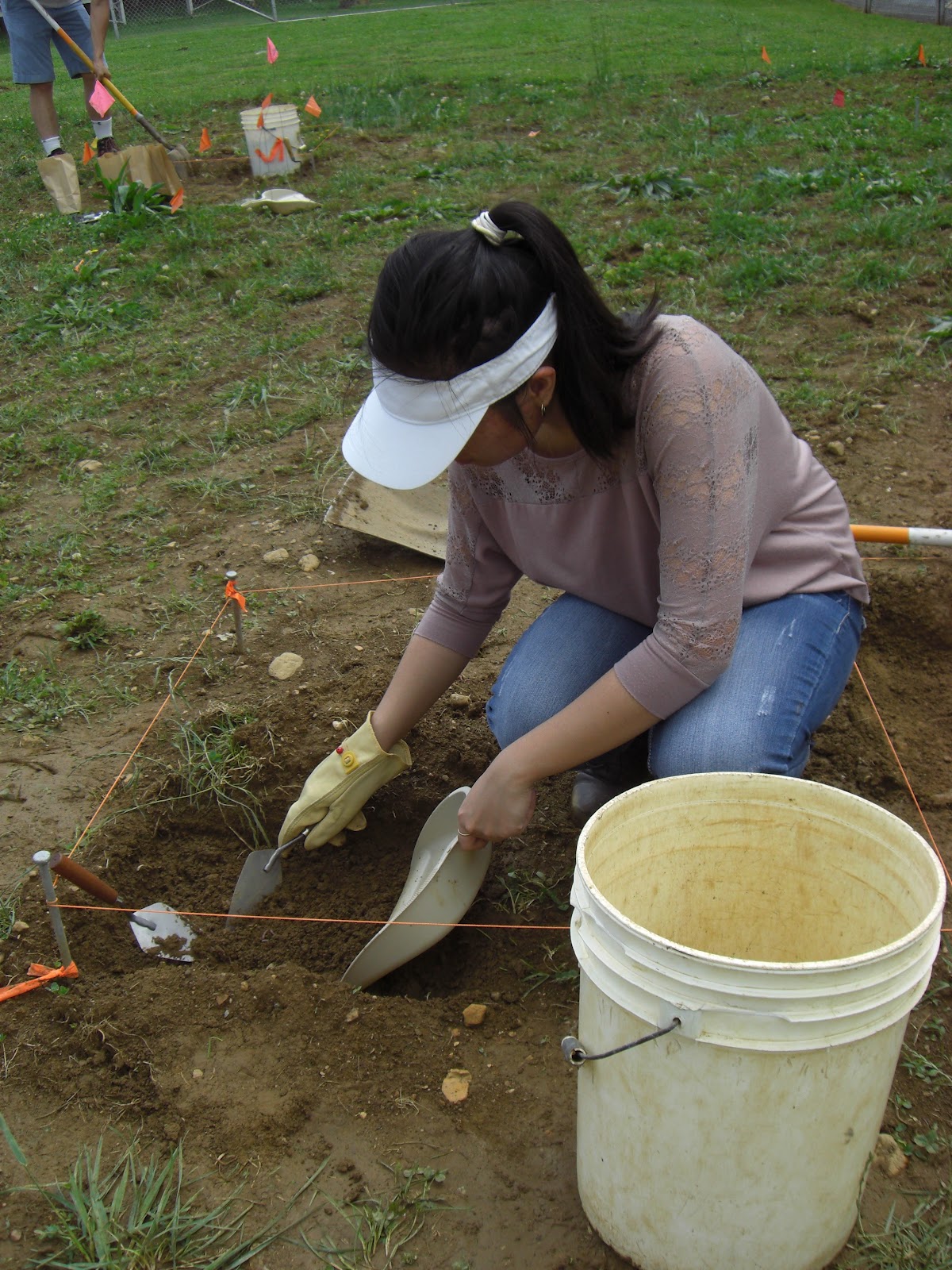
With
anticipation, students started the “dig” this week. Field work began with the students
conducting a controlled surface collection across the thirty foot by thirty
foot site and placing flags where they found artifacts. This was followed by a
lesson on the transit and laying out the excavation grid. Archaeology is all
about mapping and identifying patterning in artifact distributions. Everything
needs to be mapped! Based on the controlled surface collection, six teams of
two students each selected a one meter unit for excavation. Using the
principles of the Pythagorean Theorem (A squared + B squared = C squared), the
students placed stakes at the corner of their squares, connected them with
string and began digging. The plowzone was excavated with shovels and the soil
was screened. The students had been taught that the artifacts in the plowzone
were out of context and did not need to be mapped with the same precision as
those found below in undisturbed layers. But, once in the subsoil, they began
carefully digging with trowels and brushes.
The
field work will continue into next week. Field notes are taken to document the
location of artifacts and features. In the lab, the artifacts will be examined
and a report developed, documenting the methods and the findings. The students will
enjoy finding “stuff”, but they will also enjoy weaving the story of how the
artifacts got to the site. Each student’s excavation report will include a
review of excavation methodology used at this site, an analysis of recovered
artifacts, conclusions drawn about the “culture” based on that analysis, and a
recommendation for further work.

Archaeology
is a multidisciplinary study and allows teachers to demonstrate basic
principles of science, geology, biology, mathematics, history and anthropology.
Simulated archaeological projects can be entertaining for the students but they
use archaeological data in multidisciplinary programs to develop critical
thinking skills. A simulated archaeological project can demonstrate a
systematic approach to scientific discovery and it emphasizes behavior rather
than artifacts. An archaeological field experience for high school students
allows teachers to answer the age old question often asked by students when
taking science math, etc… – “Why do we have to know this stuff?” This
experience leads students to see how other disciplines tie into creating the
‘big picture’ and allows them to understand why all learning is
important.

If
there are any teachers who are interested in starting a simulated
archaeological excavation, please contact us. Link to. http://www.statemuseumpa.org/archcurator.html
Bibliography
Chiarulli, Beverly A., Ellen Dailey
Bedell and Ceil Leeper Strudevant
2000 Simulated
Excavations and Critical Thinking Skills. In The Archaeology Education Handbook, edited by Karolyn Smardz and
Shelley J. Smith. pp.217-233, Altamira Press. For more information, visit PAarchaeology.state.pa.us or the Hall of Anthropology and Archaeology at The State Museum of Pennsylvania .


